|
Inka Trail
|
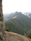
We expected this hike to be one of the highlights of our trip, and we were not disappointed. The map at the right gives you the general location of the trail in Perú, but you can see the route we took in much more detail on the map below. These are the categories of photos that we brought back from this remarkable experience. Following the links in this order will give you the story of our hike:
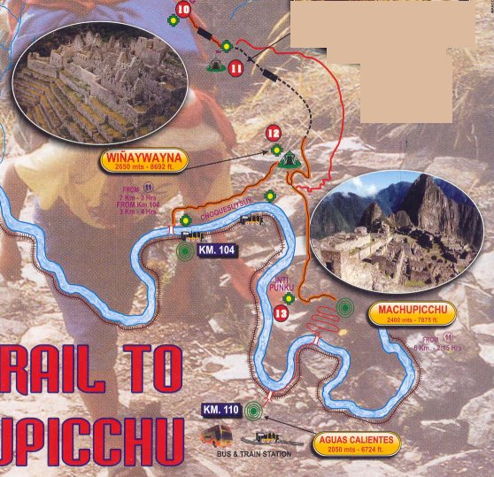
We began our hike not on the real Inka Trail, but on a spur developed for hikers who don't have the time (or maybe the stamina, which was more my concern) for the traditional 4-day Inka Trail trek. We joined up with the Inka Trail proper at Wiñaywayna, which is an impressive archeological site about halfway between the beginning of our hike and its end point—Machu Picchu—as you can see on the map below. It is taken from a larger map showing the entire valley from Ollantaytambo to Aguas Calientes, the town nearest Machu Picchu. From Ollantaytambo, the only ways to get to Machu Picchu are by train or on foot. The railway from Cusco to Aguas Calientes is marked off in kilometers, and various trains let off people at KM markers 82, 88 or 104, depending upon whether they are taking the long Inka Trail hike, the traditional hike, or, like we were, the short version. Ollantaytambo is at KM 68, and Aguas Calientes is at KM 110. |
 |
All photos, unless otherwise credited, are © by Henry J. Amen III. Please do not use without permission.